Honeywell Compact Inertial Navigation System
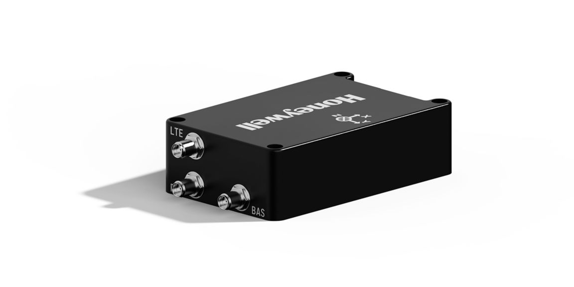
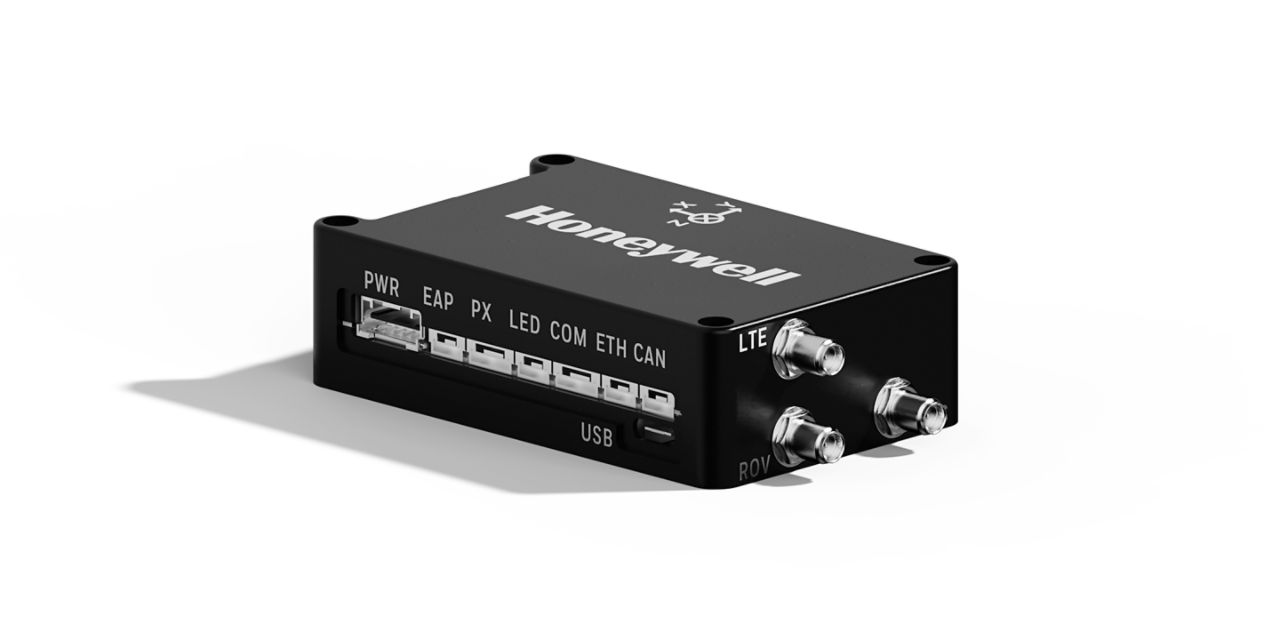
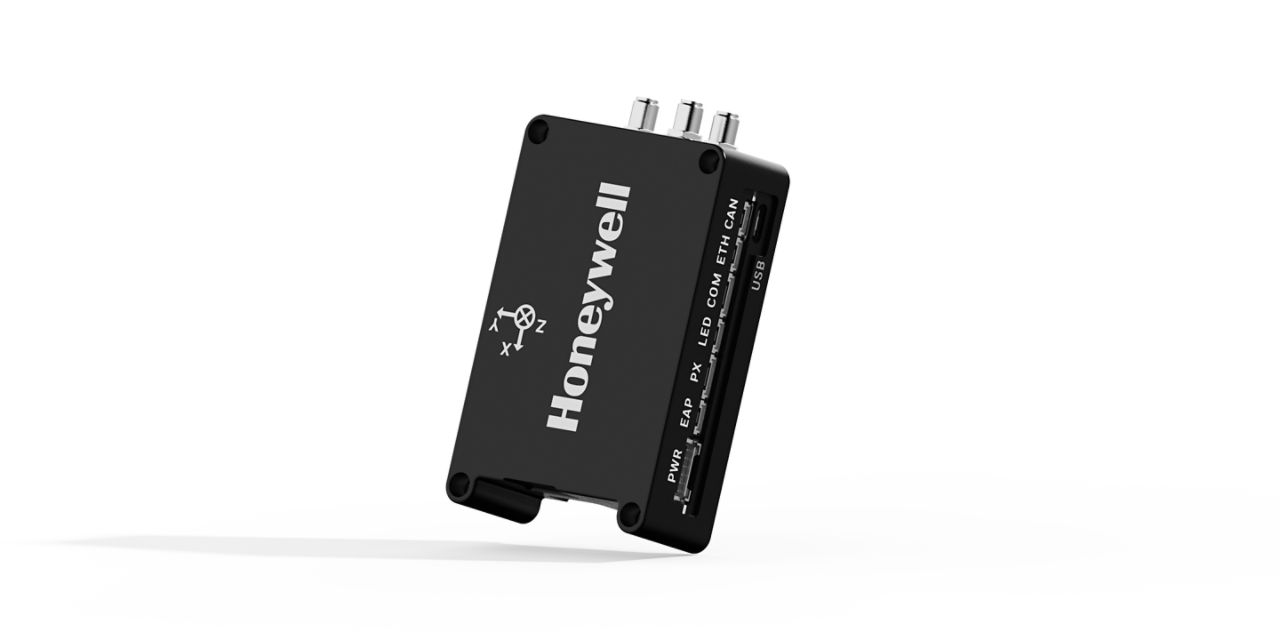
The Honeywell Aerospace Compact Inertial Navigation System (HCINS) is a low size, weight, and power (SWaP) solution designed for all classes of unmanned aerial vehicles (UAVs). Engineered to ensure safe and reliable navigation during intermittent GNSS disruptions. HCINS is roughly the size of a deck of cards and offers seamless plug-and-play integration with Pixhawk autopilot systems—making it ideal for both rotary and fixed-wing UAV platforms.HCINS is part of Honeywell’s Resilient UAV Navigation Suite, which also includes the Honeywell Radar Velocity System (HRVS) and the GPSdome Anti-Jamming System. When paired with HRVS, HCINS enables UAVs to operate in fully GPS-denied environments with a position error of less than 3% of distance traveled. The HGuide HCINS is designed and built at a Honeywell facility. It has an ECCN of 7A994 and is generally available without an export license.
HCINS is roughly the size of a deck of cards and offers seamless plug-and-play integration with Pixhawk autopilot systems—making it ideal for both rotary and fixed-wing UAV platforms.HCINS is part of Honeywell’s Resilient UAV Navigation Suite, which also includes the Honeywell Radar Velocity System (HRVS) and the GPSdome Anti-Jamming System. When paired with HRVS, HCINS enables UAVs to operate in fully GPS-denied environments with a position error of less than 3% of distance traveled.
The HGuide HCINS is designed and built at a Honeywell facility. It has an ECCN of 7A994 and is generally available without an export license.
Downloads
Specifications
| Performance: Accelerometer Sensor Technology | MEMS |
| Performance: Gyro sensor technology | MEMS |
| Performance: Roll/Pitch Accuracy | 0.02 (with RTK) |
| Performance: Position Error | 0.03/0.015 m (HCINS RTK), 2.5 m (HCINS), 2.5 m (Pixhawk 2.1) |
| Performance: Position | 2.5 m |
| Performance: Key Benefits | Compatible with Honeywell Aerospace HRVS for aerial platforms, Designed in the EU, Honeywell Aerospace advanced navigation algorithms for air, land and marine applications, Low SWaP package, Plug n play Integration with Pixhawk (Arducopter, PX4, and Mission Planner) |
| Performance: GNSS Capability | RTK, GNSS Heading (with dual antenna) |
| Performance: GNSS | Dedicated BAS (Base) and ROV (Rover) SMA connector for antenna |
| Performance: Features | Heading: 0.28 (deg), MEMS based navigator, Position Error: 2.5 m (standalone) |
Tell us your accuracy, environment, and integration requirements and we'll recommend the right board and correction approach.